Day 4: Finding the Magic in Bryce Canyon
Planning Aids:
Bryce CanyonVisitor Guide has up to date info on everything from hours, trails, map, and fees.
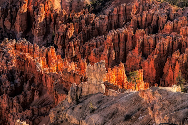
You can see the highlights of Bryce (Rock formations called Hoodoos in giant amphitheaters) in half a day or stay longer and add on some hiking. We did 1/2 day in Bryce and saved time for nearby Willis Creek Slot Canyon and Kodachrome Basin.
- if you prefer to hike in Bryce the Queens Garden Navajo Loop Trail takes you right into the hoodoos. 2.8mi/2-3hrs Strenuous at points.
We arrived in Bryce the evening of Day 3.
In the morning we had breakfast before heading out, again, it was October so sunrise was getting late. And Bryce is cold... We packed snacks for lunch.
STOP 1 Sunrise
Open 24 hrs and no shuttle required means you can get into Bryce bright and early. Arrive before dawn to view the night stars and stay for sunrise. Start at Sunrise Point and take some photos of the light on the hoodoos. Then walk north along the Rim Trail to the magic of Sunset Point, Inspiration Point and Bryce Point and back. (You can start at any of the points) This area will get crowded during the peak of the day and it is better near sunrise or sunset anyway. The amphitheater is where the magic is in Bryce. Then head over to Paria Viewpoint for a distance view of the river cutting through the canyon.
What no photos...? Did I say I was having camera troubles.? Ugh.
STOPS 2-15 Most of these overlooks on Route 63 through the park were unremarkable compared to the points along the Rim Trail. I would recommend hiking the Rim Trail to get the best views or drive to each of the 4 along the amphitheater separately. We did like two of the other overlooks in the other part of the park though, Stop 12: Natural Bridge and Stop 13: Agua Canyon (photos lower down). It's up to you if you want to drive that far to view them.
 |
| Distant View from Bryce Canyon NP* |
 |
| #13 Agua Canyon, Bryce Canyon NP* |
 |
| #12 Natural Bridge, Bryce Canyon NP* |
Willis Creek Narrows Trail
*Download driving directions before heading out because you probably won't have cell service.
Here's the scoop on Willis Creek Narrows. No bathrooms here.
Next head to Willis Creek Narrows Trail in Grand Staircase-Escalante National Monument for an easy 6 mile RT hike along the Willis Creek that will take anywhere from 1 1/2 to 3 hours. The drive there is via a 6 mile steep dirt road, Skutumpah Road, aka BLM 500. The trailhead is across the street from the parking area. I recommend a 4WD SUV for roads like this one especially if it has rained. I loved the magic of this canyon. (*BLM=Bureau of Land Management)
 |
| Willis Creek Narrows Trail* |
 |
| Willis Creek Narrows Trail* |
There are a series of really cool, picturesque narrows here. You can do as little or as much as you like and still enjoy a slot canyon type experience. If you hike all the way to Sheep Creek it will be 6 mi RT.
 |
| Willis Creek Narrows Trail* |
Kodachrome Basin State Park
If you still have time visit Kodachrome Basin State Park- $10, 6am-10pm. 2905 S. Kodachrome State Park Rd. You will receive a trail guide. You can do this towards the evening and stay for the dark skies.
Park Website It has nice bathrooms! Woo-hoo. Park Brochure
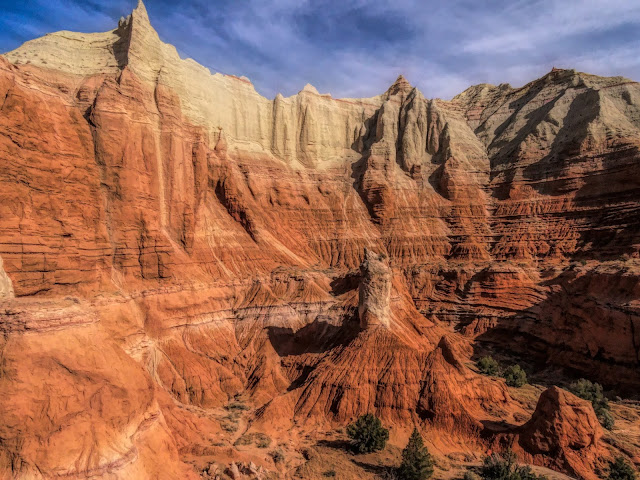
- Angel's Palace Trail: This is a scenic, relatively easy trail that gives terrific views over the basin. It is 1.4 mi long. I found the magic here. I'm not sure if it was the silence with the beautiful weather we had or just naturally magical. BTW, I would camp in this park. It looked really nice.
 |
| Angel's Palace Trail, Kodachrome Basin State Park* |
 |
| Angel's Palace Trail, Kodachrome Basin State Park* |
 |
| Angel's Palace Trail, Kodachrome Basin State Park* |
 |
| Angel's Palace Trail, Kodachrome Basin State Park* |
Bryce
Head back to Bryce for dinner & sunset. In Bryce catch the sunset at Bryce Point. Yes it is magical here! If there is a full moon it is worth coming back to Sunset Pt when the moon is up lighting the hoodoos. If there is no full moon, enjoy the dark skies instead.
 |
| Bryce Canyon from Rim Trail* |
 |
| Bryce Canyon from Queens Garden Trail* |
 |
| Bryce Canyon from Queens Garden Trail* |
 |
| Bryce Canyon from Rim Trail* Maybe Bryce Point? |
HOTEL: We stayed at Ruby's Inn, nothing special but conveniently close to the park. They also had a gift shop, market and restaurant in their main building.
Bryce Canyon is an International Dark Sky Park. I tried my first attempt at astrophotography by placing my camera on the ground facing up. Since the lens was not working properly it was luck to get anything at all. But the sky was jaw dropping compared to what I see at home - a handful of stars.
 |
| I've never seen so many stars. I have to learn astrophotography now. |
Most of the locations on this trip are also International Dark Sky Parks: Arches NP, Canyonlands NP, Capitol Reef NP, Dead Horse Point State Park, Goblin Valley State Park, Kodachrome Basin State Park, and Zion NP. My trip also coincided with a full moon so I had to time it before the moon came up.
*I packed light. My Canon 24-105L lens stopped communicating with my Canon 5D Mark IV so most of
my photos were taken with a Sony Point and Shoot. I was soooo disappointed.
But lesson learned.
Never pack light!
Click any link to go directly to that day:
Go to Day 5 Route 100, Burr Trail Road
MAPS
 |
| Bryce Canyon: Sunrise, Sunset, Inspiration and Bryce Points overlook the magical amphitheater. |
Map of Willis Creek Trailhead: https://goo.gl/maps/soEEmyG9uA2Nfkvb6
I have lots more photos of Bryce here, Willis Creek here, and Kodachrome here if you are interested.
 |
| Apparently this is what you do in Southern Utah. |


No comments:
Post a Comment